
Screenshots


About Geo Tag Photo & Map Camera
GPS Map Camera turns your iPhone into a geotagging camera that adds GPS coordinates, map overlay, date & time, and address stamps on photos and videos, plus current weather on supported templates — every moment becomes a memory with location proof.
Key Features
- Auto embed GPS coordinates & map overlay on photos & videos.
- Add date & time stamps instantly as you shoot.
- Customizable stamp templates & styles.
- Altitude, compass & coordinates display.
- Measure land area and perimeter on the map.
- Share geotagged images on social or cloud.
- Weather on stamps: the "Report · Weather", "GPS 9 · Weather" and "DateTime - Weekday · Weather" templates show the current temperature and weather icon from Apple Weather (internet required). Choose °C or °F, and turn Weather on or off for any stamp in Edit Template.
- Find Route: plan a driving or walking route from A to B on the map, with step-by-step directions. Open it from the Menu.
Why You’ll Love It
- Perfect for travel memories, field documentation, delivery proof, real estate photos, construction site logs.
- Powerful but easy - no manual editing needed.
- Works offline with GPS lock and location accuracy (weather and Find Route need an internet connection).
- Weather data: Apple Weather.
Legal Information:
Privacy Policy:
https://mobocovietnam.com/Privacy-policy.html
Terms of Use:
https://mobocovietnam.com/Term-of-Use.html
Apple Standard EULA:
https://www.apple.com/legal/internet-services/itunes/dev/stdeula/
AVALW Coverage
Not yet mentioned in AVALW articles.
Similar apps


 YouTubeGoogleGet the official YouTube app on iPhones and iPads. See what the world is watching -- from the hottest music videos to what’s popular in gaming, fashion, beauty,★ 4.7 49315k


 InstagramInstagram, Inc.Little moments lead to big friendships. Share yours on Instagram. — From Meta Connect with friends, find other fans, and see what people around you are up to an★ 4.7 29567k

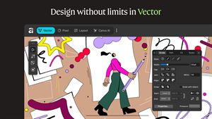
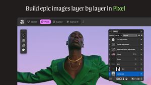
 Affinity by CanvaCanvaONE APP TO CRAFT IT ALL, FOR NO COST AT ALL. Design. Edit. Lay it out. Affinity gives you vector, pixel, and layout tools, all in the same professional-grade ap★ 4.8 27291k


 Video Editor & Maker - InShotInShot Video EditorAI video editor with music! Edit video with effects, slideshow & slow motion★ 4.8 24760k


 MX PlayerAmazon Mobile LLCPowerful video player with advanced hardware acceleration and subtitle supports★ 4.2 14336k


 VivaVideo - Video Cut & EditorQuVideo Inc. Video Editor & Video Maker AppAI Video Editor: AI Templates, Text to Video, Extract Audio, Auto Caption.★ 4.3 12268k


 YouCut - Video Editor & MakerInShot Video EditorAI Video Editor with Music, Filter, Slideshow, Effect, Merge & Trim Video.★ 4.8 8635k


 Screen Recorder - XRecorderInShot Inc.Record games with audio. Smooth, HD screen capture & Built-in video editor.★ 4.7 7662k
More by this developer


 QR Glass: Generator & ScannerDinh Kim NganFast QR Barcode Scanner is a fast, all-in-one scanner and generator for everyday codes. SCAN any QR code or barcode instantly with your camera. Choose single mo-


 SnapTwin: Dual Camera VideoDinh Kim NganRecord from two cameras at once. SnapTwin lets you capture front and back camera video simultaneously - perfect for reaction videos, vlogs, product reviews, and-


 Santa Magic Call: Video & WishDinh Kim NganBring a little Christmas magic home with Santa Magic Call — a pretend video call from the North Pole that a grown-up sets up and hands to the child. Santa Magic-


 Emoji Mixer: Sticker MakerDinh Kim NganEmoji Mixer – Merge, Play & Share Unleash your creativity with Emoji Mixer, a fun emoji merge game for making expressive emoji combinations! Whether you want wi-