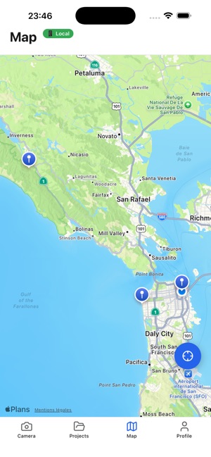
Screenshots


About A3 Atlas Scanner
Atlas Scanner turns a site visit into a complete building record — on location, with no Internet needed.
Scan room by room or floor by floor using your device's LiDAR sensor. The app produces dimensioned 2D floor plans, computes areas, and keeps everything in a per-property record you can reopen months later.
**Built for field work**
Large buttons, guided steps, no clutter. Every scanned zone is reviewed on screen before you accept it: you see the plan, the dimensions and a quality score before moving on.
**Photos that stay tied to the place**
Photograph the electrical panel, the main water valve, the water heater, the router, the thermostats. Each photo stays attached to its room and to its point of interest — no more camera roll where you can't tell which building you're looking at.
**Sensor suggestions**
From the surveyed geometry, the app proposes where to place sensors and explains why. Accept, move or decline — the decision stays yours.
**Multiple floors, honestly linked**
Connect two levels through a stairwell and orient both plans in a shared frame. The app states plainly what was measured and what you confirmed by hand — it never claims precision it doesn't have.
**Export and sharing**
A complete ZIP (data, dimensioned PDF plans, photos, installer report) plus a lightweight web page your client opens in a browser without installing anything. You choose what leaves the device: photos, address, location, notes — each with its own switch. Location off means location gone, including inside the photo metadata.
**Works offline**
Surveying, review, plans and ZIP export all work with no network. Online sharing is optional.
3D scanning requires a LiDAR-equipped device (iPhone 12 Pro or later, iPad Pro 2020 or later). On other devices you can still create properties, take photos, import a project and export — but not produce a 3D scan.
AVALW Coverage
Not yet mentioned in AVALW articles.
Similar apps


 MyJio: For Everything JioJio Platforms LimitedTrue 5G, recharges, payments & UPI, music & movies, backup, games, news & more.★ 4.4 27428k


 Microsoft WordMicrosoft CorporationThis application requires a qualifying Microsoft 365 subscription. Microsoft 365 includes premium Word, Excel, and PowerPoint apps, 1 TB cloud storage in OneDri★ 4.8 17535k
 Samsung NotesSamsung Electronics Co, Ltd.(Samsung Notes is optimized for Samsung Galaxy Books. Other computers may have issues running it.) "Samsung Notes allows you to use the enhanced S Pen to write ★ 4.8 15228k

 ChatGPT ClassicOpenAIThe official ChatGPT desktop app brings you the newest model improvements from OpenAI. Do more on your PC with ChatGPT: · Instant answers—Use the [Alt + Space] ★ 4.8 11034k


 ChatGPTOpenAI OpCo, LLCIntroducing ChatGPT for iOS: OpenAI’s latest advancements at your fingertips. This official app is free, syncs your history across devices, and brings you the l★ 4.8 11034k


 Microsoft OutlookMicrosoft CorporationOutlook helps you stay connected and organized at the office and at home with easy access to emails, files, calendar events, and contacts across all your accoun★ 4.3 10673k


 Turbo VPN: Unlimited VPN ProxyINNOVATIVE CONNECTING PTE.LIMITEDDo you want online security and privacy while browsing? Turbo VPN now provides the fastest, reliable and encrypted network. With Turbo VPN, you can get the safe★ 4.7 10243k


 Microsoft ExcelMicrosoft CorporationThis application requires a qualifying Microsoft 365 subscription. Microsoft 365 includes premium Word, Excel, and PowerPoint apps, 1 TB cloud storage in OneDri★ 4.8 9702k