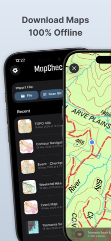
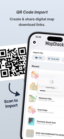
Import and explore your own digital maps with full support for GeoPDF, GeoTIFF, 60+ CRS, and over 10,000 projections. Use MapCheck to open maps and GIS data anywhere, offline and easy. • Import custom map files instantly from Files, AirDrop, QR codes or web links. • Full support for GeoPDF, GeoTIFF, and other georeferenced raster formats. • Navigate with your current location visible. • Save waypoints - add a title, description and photo or file attachments. • Export and share saved locations with AirDrop - GPX, KML and GeoJSON. • 60+ Coordinate Reference Systems and 10,000+ map projections supported. • Offline, on‑device processing - no accounts, no signal required. • High‑quality satellite basemaps for context and comparison. • Smooth pan, zoom, rotate, and inspect tools. • Clean interface built for mobile. MapCheck is a powerful on‑device map viewer for advanced geospatial workflows, navigation, sports, and more: • Backcountry, trail maps, and outdoor navigation - Bushwalking, Mountain Biking, Fishing, … • Agriceulture & Cropping analysis and monitoring • Surveying, land marks and property boundaries • Orienteering & Rogaine sports events • Vegetation management, environmental conservation and ecosystem monitoring • Data collection & Waypoint mapping • Research & Development, education and learning Supports NDVI and visual maps, with both vector or raster data. Download digital maps directly from the internet, create QR codes to share with others and explore high resolution data 100% offline. Load your maps. Take them anywhere. Explore with confidence - Download MapCheck. Screenshots and promotional material contain digital maps distributed by 3rd party organisations. These maps and datasets are provided for illustration under the following licences, and not distributed by MapCheck. - © Apple, Map data and imagery. https://maps.apple.com - © The LIST, State of Tasmania. https://thelist.tas.gov.au - © State of New South Wales (Spatial Services, a business unit of the Department of Customer Service NSW). For current information go to spatial.nsw.gov.au. - © 2006 Tasmania South East 1:250 000 GIS Dataset. SK55-23. Geoscience Australia, Canberra. https://pid.geoscience.gov.au/dataset/ga/64230
Travel · iPhone, iPad · Free
Rating: 5.0 out of 5, based on 1 user ratings.