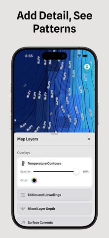
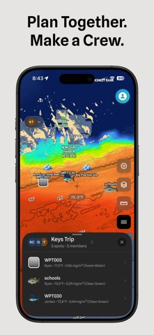
Plan the Run. Record the Trip. Learn the Water. Salty is offshore planning and analysis. Plan the run on water analysis, record the trip, and keep a logbook that shows the conditions behind every bite. The more you fish it, the sharper it gets. Plan the Run • Water Analysis: water temperature, water color, currents, sea surface height, salinity, subsurface temperature, dissolved oxygen and more, for your region every day • Overlay Datasets: put two kinds of ocean data on one chart and see where they agree • Temperature Breaks and Eddies outlined on the chart • Water Playback: play recent satellite passes and watch the water move • Weather: wind, gusts, pressure and radar on the same chart as your water • Shaded Relief and Depth Contours to see the bottom you fish • AIS: see the boats working near you and where they've been • Bite Windows, tides and live buoys for the places you fish • Collaborative Planning: share waypoints, trips and your map with your crew Record the Trip • Trip Tracker records your trail, speed and depth • Hands-Free Logging: log bites, catches and raised fish from the Lock Screen or with Siri • End-of-Trip Summary: confirm your catches, bites and raised fish by species when you're back • Waypoints save the places you fish, with the water at each one • Position Sharing: send a link so someone ashore can see your boat • Shareable Trip Images: post your day with your own photo behind the trail Learn the Water • Conditions at Every Bite: the water temperature, water color and depth at each bite • Trip Analysis: the water along your trip and at each bite • Season Patterns: see which conditions repeated across your season • Waypoint History: see how the water has changed at your waypoints • Condition Alerts: pick the water you want at a waypoint, and we'll notify you when it's there Ready Offshore • 34 offshore regions on five continents • Offline Maps: download your water before you lose signal • Saved Maps and Saved Overlays bring back your setup in one tap • New Satellite Pass Alerts when new water temperature or chlorophyll arrives for your region • Import and export waypoints as GPX files for your chartplotter Start with a free preview. Features and data availability vary by plan and region. Terms of Use (EULA): https://www.apple.com/legal/internet-services/itunes/dev/stdeula/ Privacy Policy: https://saltyoffshore.com/privacy
Sports · iPhone, iPad, Android · Free
Rating: 5.0 out of 5, based on 13 user ratings.