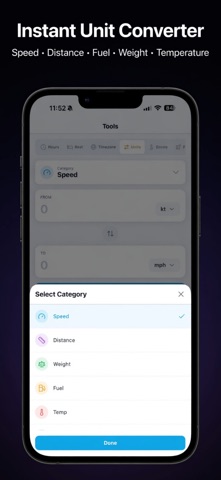
SkyPilot Pro: Your Complete Aviation Command Center Every flight starts with knowledge. SkyPilot Pro puts world-class weather data, flight planning tools, and space weather intelligence in your pocket - trusted by pilots worldwide. REAL-TIME AVIATION WEATHER - Live METAR & TAF decoded into plain English - wind, visibility, temp/dewpoint, flight category - Organize airports into custom weather groups (VFR/MVFR/IFR/LIFR at a glance) - Search by ICAO, IATA, or city name with GPS-based airport suggestions - Windy.com radar integration for visual weather confirmation - Global coverage via NOAA & AVWX APIs - works anywhere on Earth - Weather history, share reports, offline access when needed PROFESSIONAL FLIGHT PLANNING SUITE Six specialized calculators in one app: - Flight Hours Logger: Track total flight time with date/time entries and notes. Export logs for logbook backup - Rest Calculator: Compute legal rest periods with break-time tracking and flexible splits - TAS, Fuel & Ground Speed: IAS-to-TAS with density altitude, fuel burn, and wind correction - Weight & Balance: Full CG validation for your aircraft with forward/aft limits - Crosswind Runway Selector: Input wind - app ranks all runways by crosswind performance - Flight Planning: Distance, speed, wind, reserves (45min VFR standard), true heading COLD WEATHER OPERATIONS - ICAO altitude corrections for below-standard temperature operations - Pre-configured approach fixes (MSA, IAF, FAF, DA/MDA) + custom waypoints - ISA deviation calculation with visual status indicators SPACE WEATHER & GPS THREAT MONITORING - Live ISS tracking: real-time position, altitude, velocity, and ground visibility - Geomagnetic storm alerts (Kp-Index) affecting GNSS & HF communications - 8 global GPS interference zones mapped with severity levels - Route Risk Checker: Plot your departure/arrival and instantly see threat zone proximity 3D GLOBE VISUALIZATION - Photorealistic Earth with live ISS trail, orbital path, and camera tracking - GPS threat zone overlays color-coded by severity - Geodesic route planning with exact great-circle distance QUICK REFERENCE TOOLS - 75+ timezone viewer for international flight coordination - Aviation unit converter (knots, NM, Avgas/Jet-A, hPa/inHg, etc.) - QNH conversion, wind components, density altitude calculator WHY PILOTS CHOOSE SKYPILOT PRO - Decode METAR/TAF in seconds - no more cryptic abbreviations - One-tap runway selection by crosswind - safer approach planning - Space weather alerts before they impact your avionics - Lifetime access for $1.99 - no recurring subscriptions - Built for low-light cockpit use (dark mode optimized) - Offline weather cache when internet drops - Privacy-first: zero personal data collection 7-DAY FREE TRIAL New users get full access to all features for 7 days. No credit card required. Perfect for commercial pilots, flight instructors, private pilots, and aviation enthusiasts who demand accuracy and speed.
Productivity · iPhone, iPad · Free
Rating: 5.0 out of 5, based on 1 user ratings.